Hello my dear long lost readers. I really am still here, just short on spare time.
But I have wanted to share this post for awhile, as it was a very enjoyable afternoon one sunny weekend.
This is a 3 hour loop (although I did it in just under 2, but because I chose to speed along at some points) on the Eastern side of the mountain.
It runs along what used to be the Egmont Branch railway line. There are several points of interest along the way which detail some of the history of the railway line. It is quite a remote setting, although not far from a small town. I did not encounter any other hikers, but did enjoy lots of birds and lovely scenery. Funnily enough in true Taranaki fashion, it was a beautifully sunny day that just happened to decide to rain on that side of the mountain (while the sun was out of course), hence my speed walking at some points.
The railway line was set up in the early 1900's. It provide metal and rocks for constructing much of Taranaki's infrastructure, including Port Taranaki. It was closed in the 1940's. An interesting fact during the construction of the line is that in 1905 a construction worker was fired for being unmarried. In 1935 a large chunk of the line was washed out when the Manganui river flooded. The line was closed after WWII broke out, when the tracks were shipped to Europe in 1941 to help with the war effort.
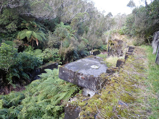
The first point of interest along the way was the site of the Barracks. Only the foundation remains now, but during the years the railway operated there were 6 cottages, a bunk house for 20 men, and a kitchen/dining area. A couple of minutes walk further along the track is the Crusher site, which was operated by water turbines. The sand trap was the only other visible structure. It filter sand out of the water used to power the turbines at the Crusher site.
Other poiits along the way included the water line, which still has some pipes in the ground beneath the walkway, and stations were rocks were sent or obtained to be sent to the quarry.
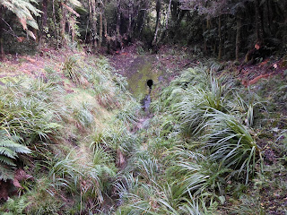
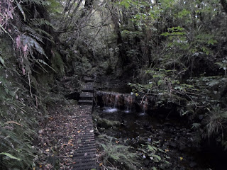
It was a lovely hike that I hope to do again some. One section in particular made me feel as if I was in a fairy tale forest. The track was built up over where the water ran through, but was down the middle of a 9-meter high gorge blasted out so the water had a direct route.
Hope to write again soon!
 |
| Barrack Site |
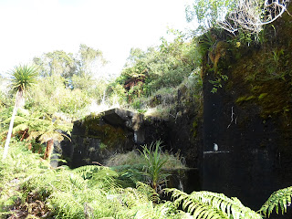 |
| 7 meter high wall of the Crusher site |
 |
| Top of the crusher site where rocks were dumped |
 |
| Site of a bridge built to transport rocks across the river |
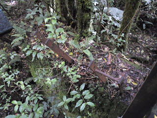 |
| Original braces for the bridge |
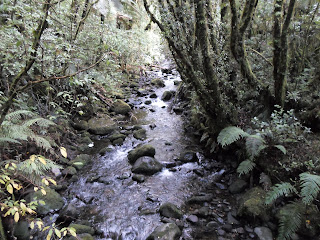 |
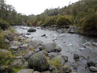
| Pretty view from the bridge |
 |
| Water pipes still in the ground |
 |
| Sand trap |
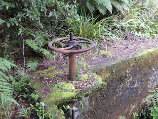 |
| Supposedly this still works... |
 |
| Rock collection site |
 |
| Can you spot where the track carries on? |
 |
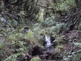
| Part of the blasted out water line |
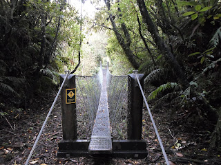 |
| Every hiking track needs a swing bridge! |


