After our nice morning of biking and pancake consumption, we headed North along the coast towards Coromandel Town. Along the way we stopped in Thames for a walk around town to stretch our legs. We ended up working our way through the Thames City Museum, which was largely a reflection of the towns development through the gold mining days. There was an interesting collection of historic farming, gold mining, and manufacturing equipment, as well as a replica of what the downtown used to be. Many of the original structures are no longer standing, either from demolition due to age or severe damage from fires.
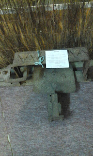 |
A man trap, you know, useful in keeping
other prospectors off your claim |
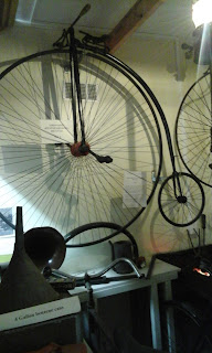 |
Wouldn't biking be so much cooler
if we still rode these? :) |
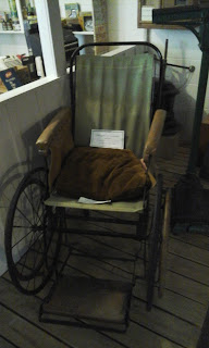 |
| Historic wheelchair |
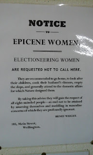 |
Notice displayed during the
days of Women's Suffrage |
The rest of our trip, other than enjoying a bit of time on the beach and sleeping in, was spent exploring a water park and hiking. One hiking excursion took us to Cathedral Cove. See posts from December 2013 for photos of that. The other major excursion was climbing Castle Rock.
But first things first, the Waterworks Park.
We picked up a brochure for the park by chance when looking for something else. It turned out to be an excellent way to spend half a day, and was a nice detour from what we normally end up seeing/doing while traveling.
They call themselves the quirkiest theme park, designed for kids up to the age of 84. Park founders/directors/maintainers have designed a wide variety of attractions, powered by water and using 70% recycled materials. There were occasional signs around the park describing how a particular attraction had been put together, and then asking for donations of things like old buckets or spoons for when it will have to be replaced.
Some of the cool attractions include flying bikes, a water powered clock, a music made from a car axle and knives, and a bicycle with a steel pole rider that appears to float on the water. There was also an impressive high-speed flying box (known in the states as a zipline). On hot days you can enjoy a swim, and if you are prepared (we were not this prepared) there are picnic and BBQ facilities.
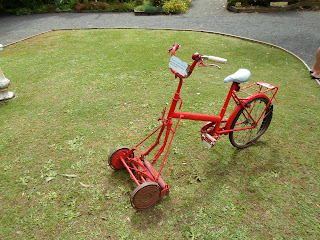 |
| Riding lawnmower |
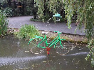 |
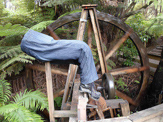
| Old bones--a floating bike! |
 |
| Cool fountain |
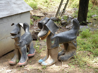 |
| Gumboot dogs! |
 |
| Created by a local artist |
 |
| Add caption |
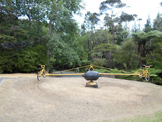 |
| Flying bikes |
When we had seen all there was to see at the water park, we thought we might just head a few kilometers down the road to Castle Rock. Castle Rock was something recommended to me by a few folks who heard where we were headed, as it was apparently known to be a nice climb that offered gorgeous views of the Peninsula.
So off we go, and find the turn-off. Now you might remember from my last post that when attempting to find a waterfall, I took us through the very scenic route to get there. I sort of did again when finding Castle Rock. We had found the right turn for the place, and did in fact find a parking lot next to the road which said it led to to the rock. What it did not say is that if you parked there, you had a 2km walk UPHILL on a dirt road until you got to the parking lot right next to where you can start your climb. So, park there we did and trudge up the hill. Gotta tell you, my calves did not thank me later haha.
Anyway, so we find Castle Rock. In my head I had imagined it was something like Mt. Paritutu that we have in New Plymouth. I guess it sort of was, but not really. Because it was an hour up to the top, where I ended up feeling a bit like a mountain goat, using roots and trees and vines to pull myself up the steep bits. Tough? A little bit (probably more because of a lack of fore-warning). Worth it? Absolutely. The views were stunning, even with it being somewhat cloudy. We could see Coromandel Town where we had stayed the night. We could see the Whitianga-Tairua area where we would stay the night before heading home. We could see islands around the top of the Peninsula, and a ways South towards the bottom of the Peninsula.
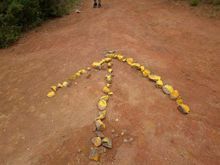 |
| Follow the yellow.....painted rocks |
 |
| Our destination |
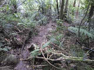 |
| A nice woodland track |
 |
| And climbing up the side of a rock |
Hope everyone has settled into the new year. We are enjoying hot humid summer here, beaches and BBQs. Speaking of that actually, we are having one tonight. Shrimp and veggie kebabs, sausages, and a new coleslaw recipe with apples and bacon in it, yum!