When I first moved here, I quickly set about visiting
as much of the North Island as I could get to, without paying much attention to
what was nearby. Now that I have been here awhile, I have had time to start
exploring Taranaki with day trips and short excursions when time and weather
allow. While I had time off over the holidays, in between holiday things and
the beach, I took a day to go hiking and check off something that had been on
my Taranaki To-Do list for quite some time.
Not far down the coast from town you will find the
White Cliffs. On clear days you can see these from Mokau, one of my favourite
places to stop along the way from New Plymouth to places up North.
Alternatively you can see a better view of the cliffs from out at sea, but I do
not have a boat so this is not a likely a way for me to view them anytime soon.
However, what I have glimpsed out of airplane windows, and from the beach at
Mokau, is lovely. The tall flat side of the cliffs, which is right at the
water’s edge unless the tide is out, is completely white.
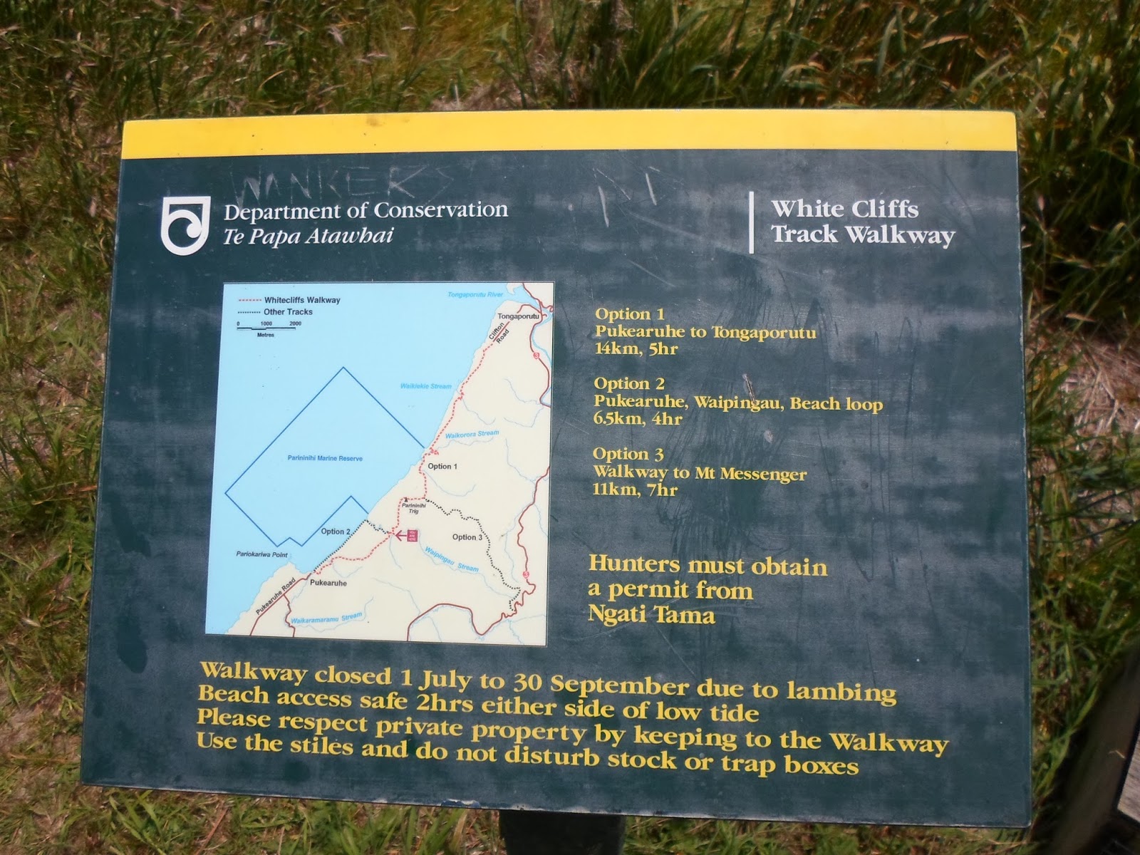
There are three options for hiking along this track,
depending on how ambitious you are. The longest route takes you from the start
of the track outside of Urenui all the way to Tongaporutu, which is next to the
Three Sisters (a 14km track). The second option takes you to Mt. Messenger (an
11km track). The third option, which was the one I chose, is 6.5 km, is a loop
through beach and farmland. Since the beach portion is only accessible at low
tide, I only did the farmland bit and doubled back the way I had started, but I
did get to enjoy lunch on the beach.
The track follows the route of the Kapuni to Auckland
gas pipeline. The laying of this pipeline enabled the track to be built, since
the work there allowed walking access to the area.
The track starts out on a one-lane paved road which
soon becomes a gravel road.


Shortly thereafter, like any good hike in NZ, you
are walking through farmland. I got to wave to sheep, horses, and cows as I
made my way through the fields. There was a nicely laid gravel track to follow
so it was easy enough to find my way.


The next portion of the track was a path
through the bush on land belonging to the Ngati Tawa Iwi (tribe). At the
highest point of this section, there was a beautiful view of Mt. Ruapehu. I
still find it amazing that you can see all the way across the island.


From there I went down a few hundred stairs, which I was glad to find since it was getting a bit steep by that point. At the bottom I found my way to the beach where I had lunch before turning back to head home. Had I wanted to carry on, I could have followed the track on to Mt. Messenger or Tongaporutu. However, it is a one way track if you do not do the beach loop, and I did not quite feel up to doing 22-28 kilometres in one day! Someday maybe I will, or someone will love me enough to meet me at the other end with ice cream and a ride home J
Some portions of the track were tougher than I had
anticipated, but the views were gorgeous and as always I found the adventure to
be a rewarding one.


No comments:
Post a Comment